Trancite AutoScene Draw is a fascinating tool for producing diagrams of occurrences and mass events, all linked to their actual locations. The software is primarily built for emergency services, and while it isn’t aimed at our business, I believe it could be beneficial to someone. The application is frequently used by law enforcement agencies and organizations that need to produce a visual plan, including: rapidly
How to make diagrams:
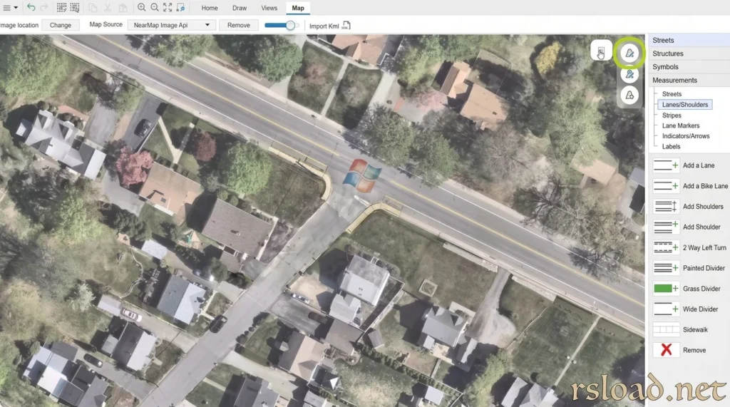
Enter an address or mark the required location on the map, and the AutoDraw tool will build the basic diagram with highways and interchanges. Unlike a conventional map image, which can be obtainedobtained from any open satellite imagery or Google Maps, the generated plan is customizable, which is fantastic. For example, it is simple to include items, symbols, and information required to document a certain circumstance. The developer’s stated creation speed depends on the scene’s complexity; thus, we evaluate everything separately.
Their program is frequently used internationally for accident and crime scene investigations, as well as parade preparation. Built-in data validation facilitates the organization of information about people, places, and objects.
A few thoughts on integration and storage:
AutoScene Draw is offered as both a desktop application and a web-based solution. It can import photos captured by drones and laser scanners and georeference them afterward. If you’re interested, visit the author’s website to verify the exact list of supported formats for the selected version.
Files can be saved on the organization’s server or in the RMS, making it easier to maintain official documents.
Pros:
- Automatic creation of the scene base
- Editable routes and objects
- Import drone and scanner data, georeference photos, integrate with reporting systems, and save files locally.